Infrastructure Evaluations
proposals found with keywords: Nil and filters: All
- List View
- Map View
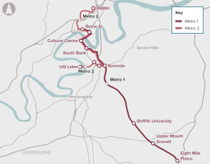
Brisbane Metro proposes a set of infrastructure and non-infrastructure changes to public transport services in inner Brisbane.

The project involves creating additional freeway lanes to the Monash Freeway, and extending managed motorway technology to deliver faster, safer journeys for users. The works respond to projected rapid population and employment growth in Melbourne’s south east and outer south east.
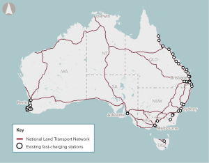
Developing a network of fast-charging stations on the national highway and policies and regulation to support charging technology adoption.
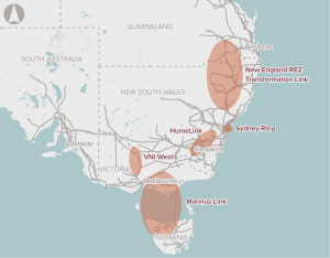
Improved connections between regions of the National Electricity market use of resources across the NEM in the medium term and ensuring system reliability and security in the longer term.
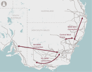
Improve interconnections between NEM regions to make better use of existing assets.
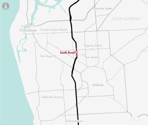
The project seeks to upgrade 1.8 kilometres of South Road to a six-lane dual motorway, and establish connections to other expressways and roads to create a continuous motorway from Gawler in the North to the River Torrens in Adelaide.

The business case is for upgrading the Tonkin Highway between Great Eastern Highway and Collier Road, and associated works, to address congestion, improve reliability, freight productivity and active transport connectivity.
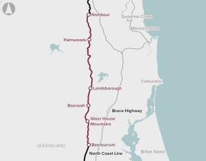
Duplication of a 20 km section of track from Beerburrum to Landsborough, as well as passing loop extensions and station upgrades between Landsborough and Nambour, to improve the efficiency of passenger and freight rail services.

Various upgrades to the Melbourne–Geelong rail line to enhance capacity, including electrification of the line and duplication of the existing single track pair.
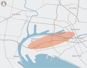
A high capacity, rapid transport link connecting Fishermans Bend with the Melbourne CBD.
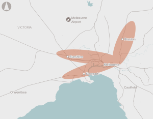
Improvements to Melbourne's rail network capacity.
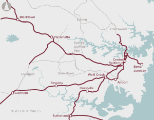
Solutions to accommodate the strong future growth in rail patronage in the Sydney basin.

The project aimed to upgrade ageing bridge and pavement infrastructure and mitigate flood risks.

The project is made up of a number of integrated above and below dam components, targeted at reducing salinity in Wellington Dam and the surrounding area, and increasing the efficiency of water distribution infrastructure.

The Cross River Rail program covers an 18 kilometre rail line, two additional surface stations and 10 kilometres of twin single track rail tunnels under Brisbane’s CBD, and four new underground stations in Woolloongabba, Boggo Road, Albert Street and Roma Street.

The project includes widening 7 kilometres of road from two to four lanes, consistent with the rest of the 16 kilometre section between Armadale and the Kwinana Freeway.
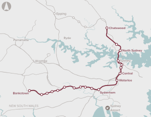
This proposal is the second stage of the broader Sydney Metro project. It is a new 30 km metro line extension from the end of the Sydney Metro North West line at Chatswood, under Sydney Harbour, through new CBD stations and south-west to Bankstown. This includes new 15.5 km twin railway tunnels from Chatswood to Sydenham, and an upgrade of the existing T3 Bankstown Line to metro operations.

The project consists of an upgrade to a four-lane dual carriageway road with bus lanes to improve public transport use in the area.

The Maldon-Dombarton Link seeks to improve freight rail access to Port Kembla with the construction of a strategic single track 35 kilometre freight line. Infrastructure Australia found that that benefits in this case would not outweigh the costs.

The Stage 1 Mackay Ring Road project (MRRP) would construct a 2-lane, 11.3-kilometre highway bypass of urban areas in Mackay with 1-in-100 year flood immunity.
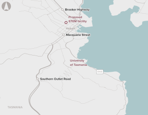
Relocation of the University of Tasmania’s Faculty of Science, Engineering and Technology from the existing campus at Sandy Bay to a purpose-built facility for education, research and training in the Hobart CBD.
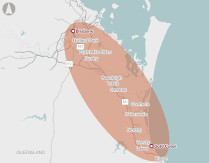
A 10-year, network-wide program for upgrades to transport infrastructure in the corridor, including road, rail, cycling and bus improvements.
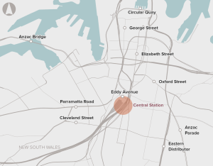
Upgrades to rail and station infrastructure to support passenger movement and interchange
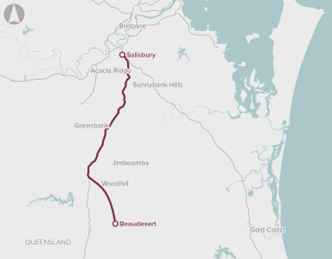
Preservation of the corridor between Salisbury and Beaudesert in Brisbane's south-west region for the potential future development of passenger rail services.

The project complements the Bringelly Road Upgrade Stage 1, by upgrading a remaining 4.3km of two-lane rural road to a four-lane divided carriageway with a wide central median, allowing for future widening.

The project seeks to address a long term underspend on maintenance, and subsequent declines in service. The project will see standardisation of the existing broad gauge rail network, and axle load upgrades to build the capability of the line.

The project seeks to address the capacity constraints of rail services in Melbourne through the creation of a new line, and five new stations, through twin 9km rail tunnels running from South Kensington to South Yarra under the CBD.
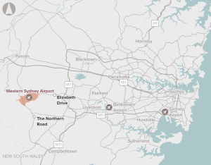
Western Sydney Airport (now Western Sydney International) will be a full-service airport catering for domestic and international passengers, as well as freight services, initially with a single 3,700 m runway capable of handling all aircraft and facilities for 10 million passengers per annum. Construction commenced in 2018 and the airport is scheduled to open in 2026.

The project would provide a new 8.5km rail spur to the airport, with three new railway stations and two bus interchanges.

The project seeks to accelerate rail replacement and upgrading of approximately 600 kilometres of track between Adelaide (Islington and Outer Harbour) and Tarcoola.
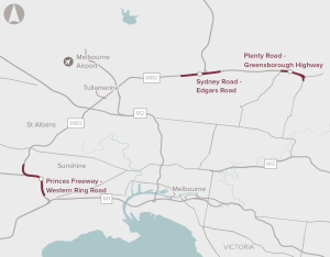
Additional capacity along three sections of the M80, which in total comprise 14 kilometres of the 38 kilometre M80 Freeway.
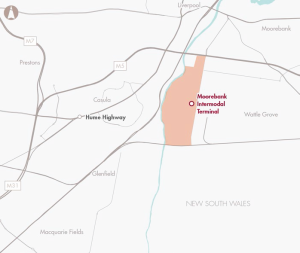
A package of inter-related road infrastructure improvements to increase network efficiency and improve access to the Moorebank Intermodal Terminal

The project seeks to address congestion, delays, flooding and safety concerns by upgrading and widening a 7 kilometre corridor between Caloundra Road and the Sunshine Motorway.

The project would reduce congestion by reducing existing motorway merge points and reconfigure bus ramps. The Pacific Motorway between Tugun and Brisbane is the busiest road corridor in Queensland, and is part of the National Land Transport Network between Sydney and Brisbane.

The project will widen the motorway from four to six lanes, include a cycleway, and develop a range of new and upgraded ramps and bridges.

The project proposes the upgrade of about 3.3 kilometres of South Road between Tonsley Boulevard and the Southern Expressway, with the implementation of new lanes, interchanges, an overpass and the implementation of intelligent transport systems.
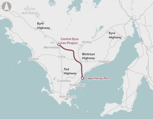
Development of a deep water port at Cape Hardy, and a 148 km heavy-haul, standard gauge rail connection between the mine and the port.

The project involves the development of an intermodal freight terminal which will increase the capacity of imports and exports out of Port Botany and connect by road to the M5, and by rail to the proposed Southern Sydney Freight Line.

The project involves the closure of three motorway ramps, the upgrade of three ramps, an additional lane in both directions over a 2km stretch, a new one-way service road, upgrades on two bridges, and pavement rehabilitation.

The project proposes to widen a 5km section of the motorway from four to six lanes, providing an additional 50% in traffic capacity and easing congestion costs.
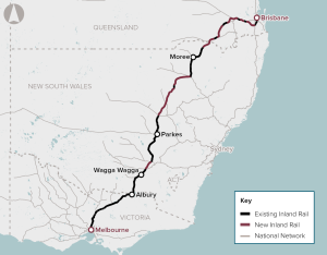
Construction of a freight rail line of approximately 1,700 km between Melbourne and Brisbane via inland Victoria, New South Wales and Queensland.

The project extends the Mitchell Freeway by six kilometres, and undertakes improvements to expand road capacity and reduce nationally significant levels of congestion in Northern Perth.

WestConnex is a 33 kilometre motorway scheme, aiming to increase capacity on Sydney’s road network and strengthen links to the network including the M4 and M5 motorways, and Sydney Kingsford Smith Airport.
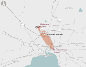
Develop options for increasing public transport capacity to Melbourne Airport.
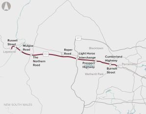
Redevelopment and expansion of M4 Motorway to cater for population grow and increasing congestion.
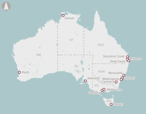
A portfolio of works focused on addressing congestion on urban road networks with comparatively high public transport and freight use across multiple corridors in Australian cities.
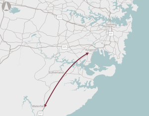
Deliver a motorway connection from the M1 at Waterfall to the Sydney motorway network.
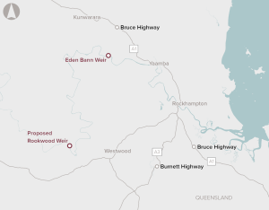
Increasing water storage in the region by constructing a new weir at Rookwood on the Fitzroy River
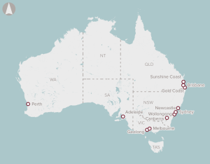
A program of works focused on addressing capacity constraints and improving service levels on urban and regional rail networks.
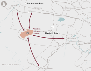
Infrastructure upgrades to support bus connections between the proposed Western Sydney Airport and the nearby centres of Liverpool and Penrith. It does not preclude direct rail access in the future.
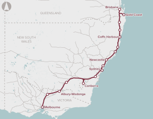
Preserve the corridor for a high speed rail link between Melbourne, Sydney and Brisbane.
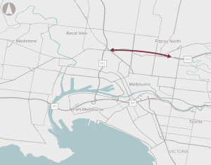
Improve the connection between the Eastern Freeway and CityLink.
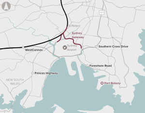
Connection from WestConnex at St Peters to Sydney Airport and Port Botany.
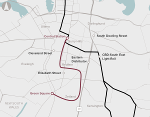
Provide high-capacity and rapid transport link between Sydney CBD and unserved parts of Green Square.
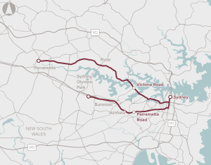
Provision of high-capacity, on-road bus transport to improve connectivity along priority corridors.
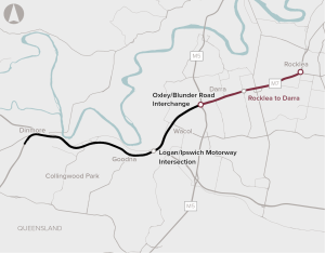
Improvements to road capacity along the Ipswich Motorway between Rocklea and Darra by providing additional lanes, upgrades of bridges and ramps and other provisions.
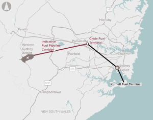
Identify and preserve a corridor for a fuel pipeline connection between the Sydney fuel pipeline network and Western Sydney Airport.
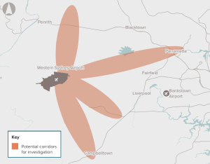
Preserve the rail corridor connecting the Western Sydney Airport to the Sydney rail network.
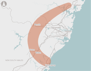
Conducting a planning study to identify a preferred alignment for a multi-modal transport corridor comprising a motorway, a north-south freight rail line, and where practical, passenger rail, and to preserve the preferred corridor.
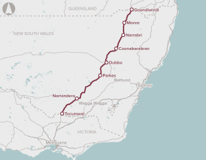
Improvement to several sections of the highway to support safe Higher Productivity Vehicle access, and improve safety and reliability
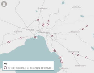
Removal of priority level crossings to deliver a more reliable, convenient, productive and safer transport system in Melbourne.
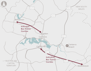
An integrated transport solution through developing bus transit corridors between Belconnen and Queanbeyan to central Canberra.
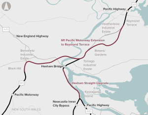
Upgrades of the Pacific Highway to motorway standard between John Renshaw Drive and Raymond Terrace.
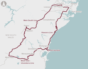
Improvement in rail freight access to Port Kembla, potentially through enhancements to existing lines, or the future development of an alternative rail alignment to the port.
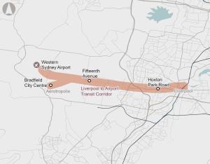
Recommended for investment to support the New South Wales Government to undertake planning for improved public transport between Liverpool, the new Bradfield City Centre, and Western Sydney Airport.
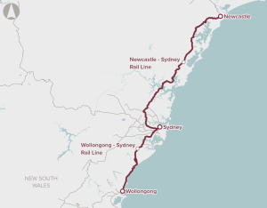
A package of improvements to passenger rail services between Newcastle and Sydney and Wollongong, including operational and fleet improvements, grade improvements and a new rail crossing of the Hawkesbury River and Illawarra Escarpment.
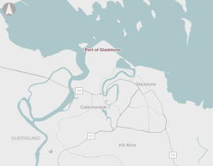
A range of activities, such as channel management to increase export capacity, upgrades to road and bridge infrastructure servicing the port, and new rail infrastructure to provide direct connections.
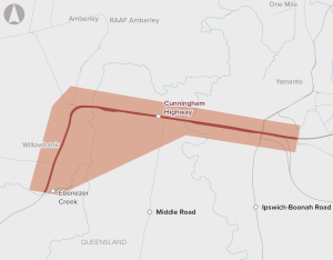
Upgrades to a 4.75 km section of the Cunningham Highway between Warwick Road at Yamanto and Ebenezer Creek, including the Amberley Interchange.

Additional tracks from West Ryde to Rhodes and from Thornleigh to Hornsby to support the future growth of rail freight movements.
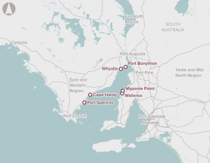
Identification of potential options for the development of bulk commodity port capacity in the Spencer Gulf region.
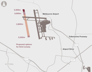
A third runway to meet increased demand at Melbourne Airport, which is expected to reach capacity during peak periods between 2018 and 2022.
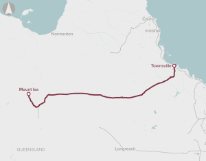
Enhancements to western sections of the Mount Isa to Townsville Rail Corridor and construction of a new 6.5km Townsville Eastern Access Rail Corridor.
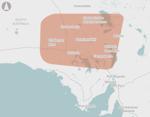
Building and operation of a 350 km railway in the Gawler Craton province, linking to the existing interstate rail network. Future connections to other potential mining plans will be possible.

Rationalise existing sewage treatment plants and upgrade and operate a reduced number of sewage treatment plants in Hobart, Launceston and Devonport.
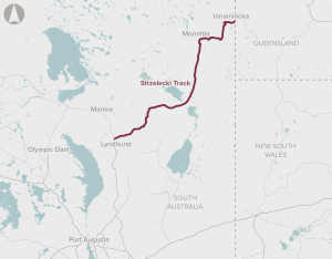
Upgrades to 426 km of the Strzelecki Track between Lyndhurst and Innamincka, and 26 km of the Nappa Merrie Access Road

Construction of an additional runway at Perth Airport to provide capacity needed to meet increasing demand.
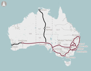
Delivery of a wireless satellite communications-based train control system, that will replace line-side signalling to improve rail capacity, transit times and rail safety.
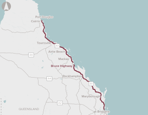
A broad package of works to progressively upgrade priority sections of the Bruce Highway to address specific capacity constraints, flood resilience and safety concerns.
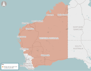
The proposal proposes a program of works to improve road access to remote Western Australian areas.
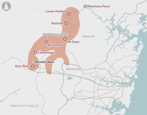
The Hawkesbury–Nepean Valley Integrated Flood Management Strategy presents a series of proposals and investments to reduce flood risk in the valley
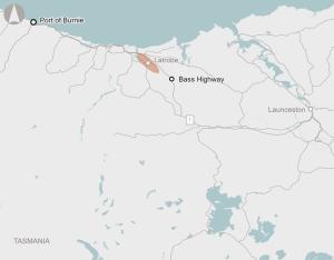
Recommended for investment to support the Tasmanian Government to undertake planning activities for upgrades at Latrobe on the Bass Highway.
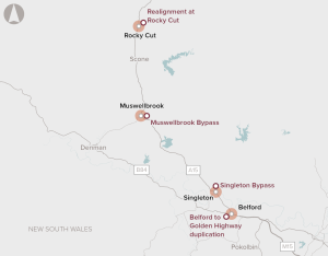
A number of potential developments, including bypasses of the towns of Singleton and Muswellbrook, and intersection upgrades.
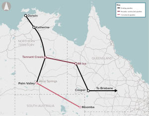
The initiative would develop infrastructure to connect northern and/or western Australian gas reserves to the eastern gas markets
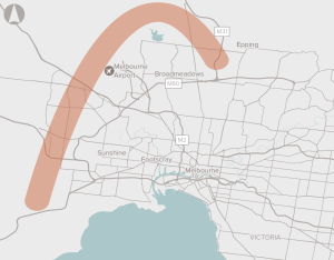
Preserve the corridor for the Outer Metropolitan Ring Road and E6 in Melbourne.
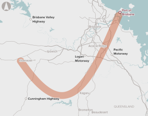
Improve connectivity between the Port of Brisbane and freight terminals in the Brisbane region.
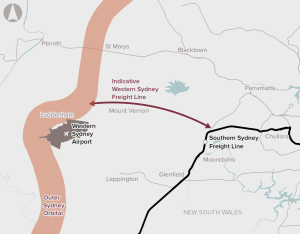
Reduce growth in truck movements on the Sydney road network and reduce delays to freight trains on the main Western Line through preservation of the corridor
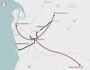
The 2019 Australian Infrastructure Audit found that the performance of urban roads and urban public transport in Adelaide is a key challenge for South Australia.

Widening of the Tullamarine Freeway and CityLink (to the M1), by at least one additional lane in each direction; the implementation of a Motorway Management System; and various other works and upgrades.

The project is based on an unsolicited proposal from private sector proponents to finance, design, build and operate NorthConnex, in order to reduce traffic congestion around Pennant Hills Road with a new, tolled motorway.

The project involves the removal of a level crossing at St. Albans, the lowering of the Sunbury rail line, the relocation of carparks, bus interchanges, and the construction of a pedestrian overpass and a new underground rail station.

The project would deliver a four-lane divided highway for approximately 37 kilometres, responding to congestion and road safety concerns on the Princes Highway.

The project seeks to provide a high standard road freight link in several areas around Roe Highway and Fremantle Port.

The initiative seeks to upgrade 5.1km of road, widening the existing two-lane single carriageway road to a four-lane (and in part six-lane) dual carriageway road divided by a central median. It aims to reduce the crash rate and support forecast high population growth in Sydney’s south-west.

This initiative aims to develop five new irrigation schemes across Tasmania, including the construction of four dams and pipelines, and the construction of an off-river storage and pump.

Between 2009 and 2011, Infrastructure Australia recommended that the Pacific Highway Corridor Upgrades initiative from Hexham (NSW) to the Queensland border be rated as ‘Ready to Proceed’ on the Infrastructure Priority List.

The project seeks to upgrade 10.5km of the F3 freeway by widening the freeway from four to six lanes, in order to improve the productivity and capacity of the road. Infrastructure Australia recommended the development of a transport plan and robust benefit–cost analysis.

The project seeks to upgrade the road’s Intelligent Transport System (ITS) from Level 1 to Level 3, providing variable speed limits and lane use managements to mitigate delays and manage incidents.

The initiative consists of 87km of road upgrades in the Wheatbelt region of Western Australia, connecting Perth to the north-west.

The project involves the creation of a four-lane divided road for freight vehicles to and from the Port of Fremantle (with capacity for ultimate expansion to six lanes) while retaining the current High Street as a local access road.

The proponent, Main Roads Western Australia, is seeking Commonwealth funding to conduct road widening in the Pilbara region, with an aim to improve the efficiency of the freight task. Infrastructure Australia recommended the development of a detailed business case.